MaraMap
Repurposing scientific datasets to bring coastal heritage to life
The Challenge
Scotland’s west coast is a hub for marine tourism activity. From marinas to historic lighthouses to wildlife hotspots, it is an area that attracts a variety of visitors, all with a range of independent and intersecting interests.
Part of a CAPITEN (Atlantic Cluster for Technological and Economic Innovation in the Nautical Sector) project, The University of Highlands & Islands wanted to create a tool that displayed information from all these activities. This would be used by visitors as a reference point, to help them embrace all the area has to offer.
The challenge was to establish the best way to communicate this diverse data, including those pulled from more complex data sets and advanced sources to general users. Making the resource accessible and engaging to general users was paramount.
Solution
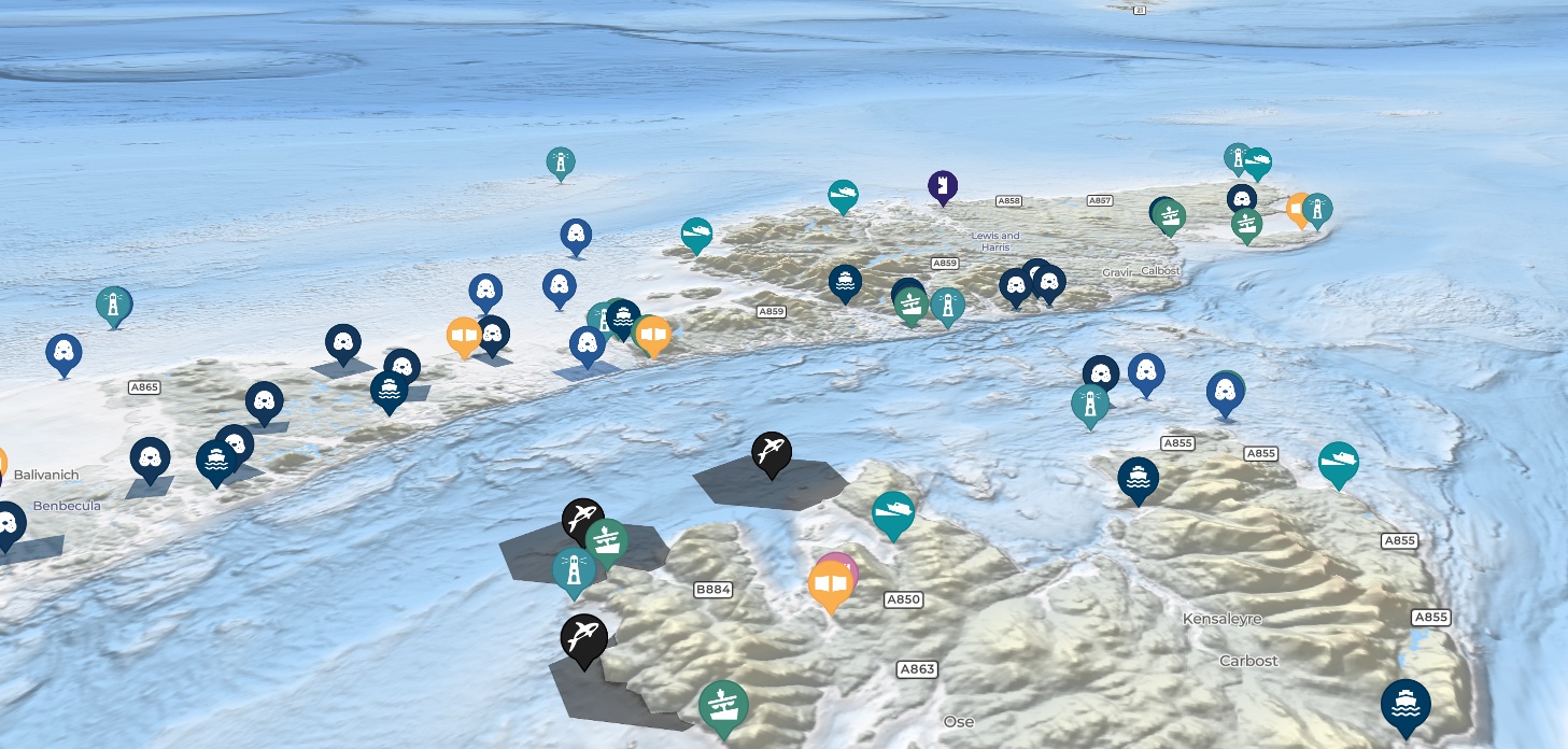
Given the parameters and aims of the project, a digital, interactive map was decided as the best method to convey the west coast’s rich marine activity. To support this, an exploration of the available research and academic datasets was conducted which established the best data to use to encourage visitors to the area and safely into the water.
Marine hub datasets formed a backbone to the map, highlighting detailed mooring and marina information for those travelling by boat. In addition to this, the map included a large and comprehensive variety of other data sets for users to explore. This includes:
-
Marine Hubs
- All Scotland’s west coast commercial ports, piers, harbours, jetties, pontoons, marinas and slipways
-
Marine Trails
- Marine trails including the Hebridean Whale Trail, Argyll Sea Kayak Trails and Snorkel Trails
-
Beaches
- The best beaches for visitors to get into the water as identified by local students
-
Ferries
- Ferry ports to help visitors travel to the islands
-
Shipwrecks
- Shipwrecks under the routes of the ferries
-
Lighthouses
- Lighthouses provided by the Northern Lighthouse Board
-
Castles & History Sites
- Castles and historic sites provided by Historic Environment Scotland
-
Whales & Dolphins
- Whale, Dolphin and Porpoise sighting hotspots identified by the Hebridean Whale and Dolphin Trust
-
Seal haul-outs
- Seal haul outs and otter sighting hotspots identified by the Sea Mammal Research Unit
-
Seabirds
- Seabird sightings provided by the Sea Watch Foundation at Bangor University and the Royal Society for the Protection of Birds
-
Coral Reefs
- Coral Reefs provided by NatureScot
-
Filtering
- Filtering to allow boat visitors to find marine hubs by their facilities
Outcome
The MaraMap now exists as a comprehensive guide to Scotland’s west coast. Previously inaccessible data, such as those of marine wildlife, is now available for all to consume, enjoy and act on. The map acts as a vital resource for those wishing to explore the area and safely navigate its waters and helps those that visit make memories to last a lifetime.
Contact Us
Where we are
Edinburgh
EH3 7LA